Drone Secured for Monitoring Marine Creatures, Including Whales and Seabirds, in Kamchatka
In the remote and rugged protected area of Kronotsky Zapovednik, Kamchatka Krai, drones are transforming the landscape of wildlife conservation. These innovative tools are enhancing the accuracy, efficiency, and scope of ecological research in this vast wilderness, where ground access can be challenging.
Drones are providing high-resolution aerial imagery and video, enabling researchers to conduct surveys over difficult terrain without disturbing wildlife. This technology is particularly valuable in Kronotsky Zapovednik, where it facilitates counting and tracking key species such as brown bears, reindeer, sable, birds, and even marine mammals like gray whales, sea otters, and Steller sea lions.
The drones are equipped with cameras and sometimes thermal imaging, allowing for repeated monitoring to detect changes in population size and distribution over time. They are also used for habitat mapping, capturing detailed images of vegetation types and habitat features to better understand the relationship between wildlife populations and their environment.
One of the significant advantages of using drones is minimizing human disturbance. As Kronotsky Zapovednik has strict protections, the reduced need for intrusive human presence helps to minimize stress and disturbance to sensitive species. This is especially important when counting sea otters and monitoring bird colonies, including Pacific gulls and Kamchatka and river terns.
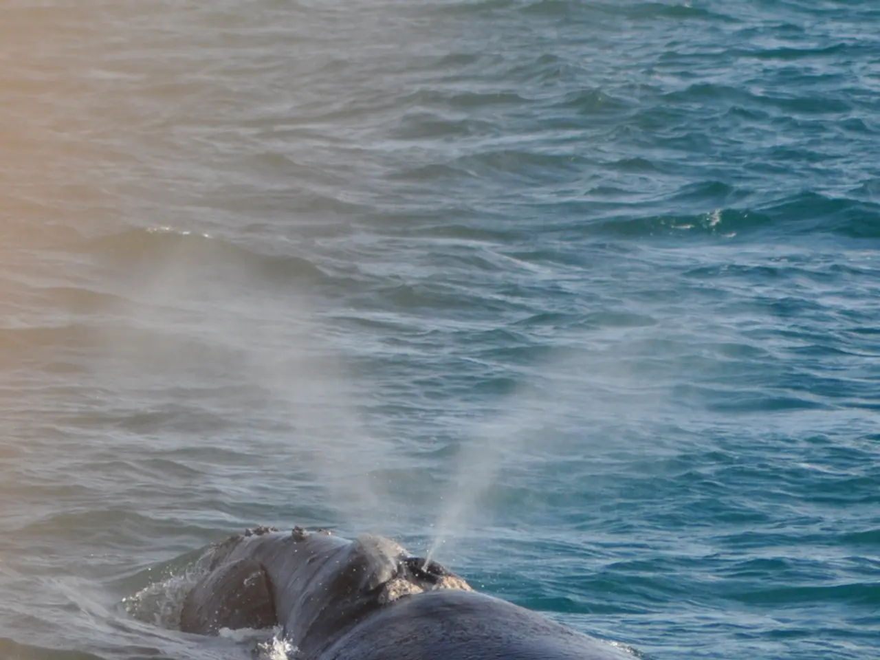
Drones also increase data collection efficiency. Drone missions take less time than traditional ground surveys and can cover larger areas systematically, providing comprehensive data sets that improve the accuracy of wildlife monitoring programs. For instance, aerial photography from drones increases the accuracy of assessing the physical condition of gray whales, and the top view provided by drones details interactions between whales that are often limited to views of fin and tail splashes when observed from a boat.
The "Natural Systems of Siberia, the Far East, and other Russian regions" program of the charity foundation is at the forefront of this technological advancement, focusing on Wildlife Population Monitoring. The foundation also funds the purchase of additional gear for the wildlife reserve's protection service. In 2024, a three-year project dedicated to preserving the wild reindeer population of Kamchatka began under the same program.
Unmanned aerial vehicles (UAVs) are also effectively tracking the success of gray whales' feeding in the waters of Kronotsky Gulf. Safe distance photography allows for effective counting of the number of nests or breeding pairs of birds, and remote determination of nest occupancy or the number of chicks in bird nests is possible with the use of drones without disturbing the birds.
Moreover, drone photography offers new prospects for photo-identification of animals. Unmanned technologies are used for observing the nests of birds of prey, such as the white-tailed eagle. Air observation minimizes disturbance when counting sea otters and allows monitoring regardless of sea weather conditions.
Equipment is purchased to ensure uninterrupted communication and sustenance for the outposts under the "Antipoaching Territory Protection" direction. This field season plans to use drones to count Stellar sea lions on their reproductive haul-out site at Stone Kholm. The success of feeding serves as a key indicator of the gray whale population's well-being.
In summary, the implementation of modern monitoring technologies, including drones, in Kronotsky Zapovednik is revolutionizing conservation efforts. These technological advancements enable precise, non-invasive, and efficient monitoring of wildlife populations across this ecologically significant region, supporting the preservation and protection of its diverse and vital wildlife.
Drones, equipped with cameras and sometimes thermal imaging, are being used in Kronotsky Zapovednik to provide high-resolution aerial imagery and video for conducting surveys over difficult terrain, which helps to minimize human disturbance and ensure precision in ecological research. Furthermore, this technological innovation is essential for understanding the relationship between wildlife populations and their environment, as it facilitates habitat mapping and repeated monitoring to detect changes in population size and distribution over time.


